Strategy in the skies: Russian drones attempt deception in Ukraine
The war in Ukraine compels both sides to employ tactics that could offer even the slightest advantage in battles. One such tactic, previously unseen on the front line, involves Russians attempting to deceive Ukrainians by using specific inscriptions on drones.
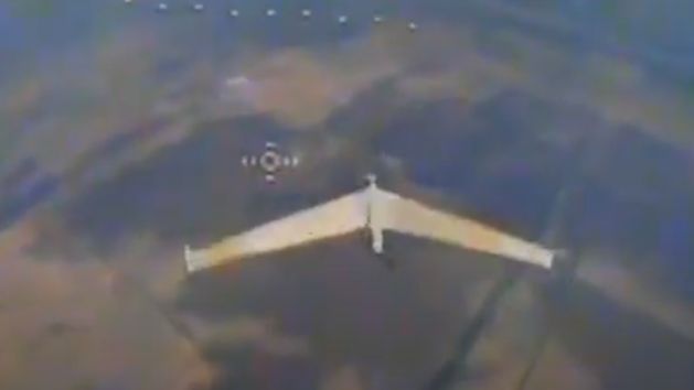

"Don't touch me, guys. I'm on your side" – this inscription is visible on a Russian Zala 421-16E reconnaissance drone, a photo of which Ukrainians have shared online. This marks the first time in the history of the Ukrainian war that such an image has appeared on social media.
The most probable explanation for this Russian tactic is an attempt to mislead Ukrainians into believing the drone belongs to allied defender forces.
Commenters on the photo of the Zala drone with special inscriptions also speculate that the Russian Federation might not only be trying to deceive Ukrainians but also protecting itself from so-called friendly fire. In Russia, "friendly fire" incidents have often destroyed valuable Russian machines. This phenomenon is well-documented.
The drone in the Ukrainians' photo is an important tool for the Russian Federation's forces. Unlike typical kamikaze-type unmanned aerial vehicles that identify targets and strike them, the Zala 421-16 is a reconnaissance drone. It can stay aloft for several hours and conduct surveillance from altitudes of up to 3,500 metres, providing high-resolution images.
The Zala 421-16E was developed to meet the Russian Federation's need for equipment with reduced detectability and capable of conducting high-altitude surveillance. The drone has a digital SLR camera with a resolution of at least 18 megapixels, enabling it to transmit Full HD images to allies with up to 20x zoom. It also includes a gyroscope for image stabilisation and a thermal imaging camera.
This device is powered by an electric motor that allows the drone, weighing about 10 kilograms, to reach altitudes of up to 3,500 metres. At this altitude, it can conduct reconnaissance for four hours, travelling at a speed of 112 kilometres per hour. Its range slightly exceeds 200 kilometres, while its operational radius is around 45 kilometres. Precise location determination is managed by GPS/GLONASS navigation in cooperation with a three-axis magnetometer.


